TSUKUBA FUTURE
#120 Listening to the Earth's Voice
Assistant Professor OKUWAKI Ryo, Institute of Life and Environmental Sciences

The Earth is covered with a layer of rock called plates, each approximately 10-100 km thick. These plates move and interact with each other at their boundaries, sometimes colliding or passing by each other, or one plate subducting beneath another. These movements subject the rock to pushing and pulling forces, which can result in a fault rupture and an earthquake. Japan is an earthquake-prone country because there are multiple plate boundaries in the vicinity.
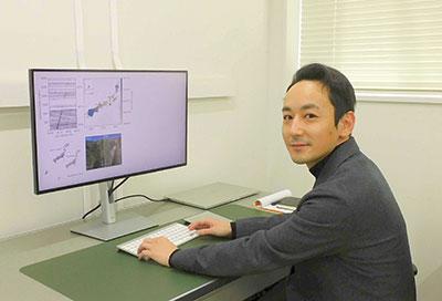
One of Okuwaki's main research themes is understanding the process of earthquake-rupture growth. Using seismic waveforms recorded worldwide, he analyzes how faults of any geometry rupture and what kind of seismic waves accompany them.
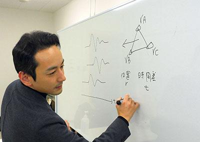
In a typical source-process modeling, the fault geometry is prescribed in a model a priori, which is then tested to see if the seismic waveforms can be explained by that model. However, if the assumptions are not well-made, peculiar or subtle movements of the fault beyond the model capacity may not be found. Therefore, Okuwaki utilizes a method called "Potency Density Tensor Inversion," developed by his supervisor and colleague, Professor Yuji Yagi (Institute of Life and Environmental Sciences). This method estimates the fault geometry that caused the earthquake and the growth process of the associated rupture from the observed seismic waveform data itself.
The Earth is active and exhibits dynamics.
We want to know how these are driven.
When applied to the Palu earthquake (M7.6) that occurred in Indonesia in 2018, Okuwaki and colleagues found that the seismic rupture was in the style of an inchworm-like rupture that repeatedly advanced faster and slower for approximately 150 km. Although the fault appears straight there were bends in places that either hindered or sped up the rupture process. This was the first time in the world that the relationship between the complex fault geometry and the irregular behavior of earthquake rupture was elucidated from the observed data.
A similar analysis of the 2016 Romanche earthquake (M7.1) on the transform fault in the Central Atlantic Ocean revealed that the rupture evolution exhibited a peculiar pattern that apparently changed its direction midway, like a boomerang. A transform fault is an area where two plates pass each other horizontally. Although the shape is apparently simple, the boomerang rupture was thought to have occurred due to the heterogeneous structure of the transform fault. This knowledge can impact the prediction of the ground shaking and attempts for disaster prevention.
The idea of utilizing buried signals in the seismic
records led to the development of a landslide detection
method.
Okuwaki studied abroad at the University of Leeds in the UK for 2 years from March 2020. The university is a world leader in imagery of crustal deformation, including that one associated with earthquakes. By combining satellite observation data with seismic waveforms, more robust and detailed analyses of the earthquake-rupture process can be made. Despite the pandemic causing him to be house-bound on some days, it was a great opportunity for him to interact with the researchers there and create a network.
Okuwaki's interest in earthquake research began during his first year as an undergrad student at the College of Geoscience at the University of Tsukuba. Through his classes, he learned about the dynamic nature of the Earth, including earthquakes and volcanoes.
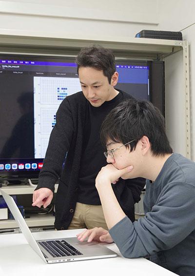
Ideas always emerge through discussions with students.
Even without earthquakes, the Earth is constantly shaking due to the movement of the atmosphere and oceans, and the other surficial phenomena, including landslides. Okuwaki and his colleagues have developed a method to detect landslide shaking utilizing the densely distributed seismic networks and identifying the location and timing of the vibration sources. Landslide shaking is often subtle compared to that of earthquakes, making it difficult to determine when the signal reaches the observation point. Okuwaki and his colleagues developed a new method to estimate the location and time of the occurrence based on the time difference between the arrivals of similar waves at each observation point.
By applying this method to the seismic records in September 2011, when Typhoon Talas (no. 12) swept across Japan, they were able to detect landslides that occurred in the Shizuoka and Mie prefectures. The new method is expected to facilitate the early detection of remote landslide occurrence and reduction of disaster risks.
Japan has a vast amount of rich seismic records, which may contain unknown information, such as the clues to untangle the relationship between climate change and the solid Earth's vibration. The seismic records are not just the records of earthquakes but also the records of Earth's voice, which may be telling us hidden secrets of the Earth's dynamics.
Article by Science Communicator at the Bureau of Public Relations